Friday, June 29, 2012

Acoustic Theory and Sound Velocity

Alright, today I'm going to talk about acoustic theory and sound velocity. These are very important things when collecting multibeam data, so I though it would be appropriate to dedicate a post to it.

What is sound velocity? It is the speed at which sound travels (through salt water, fresh water, air, etc.). There are many different things that can influence sound velocity, especially in the ocean. The main influences are:

- Conductivity (salinity)
- Temperature
- Depth (pressure)

Just to give you an idea of how these factors impact sound velocity, here are some figures:

1 degree Celsius change in temperature ---> 4.0 m/sec change in velocity
1 ppt (parts per thousand) change in salinity ---> 1.4 m/sec change in velocity
100 m change in depth (or 10 atm's pressure) ---> 1.7 m/sec change in velocity

SALINITY
On average the ocean contains 32-38 ppt (parts per thousand) of salinity. Some of the influences on salinity include:

- Evaporation
- Prescipitation
- Fresh water influx from rivers
- Tidal effects

TEMPERATURE
Temperature is one of the major influences on sound velocity. Some effects on temperature include:

- Solar heating
- Nighttime cooling
- Rain/runoff
- Upwelling

REFRACTION ERRORS
Applying the wrong sound velocity profile to your data can result in refraction errors. Visually, the swath will curl up in a convex manner if the velocity is higher than supposed to be. The swath with curl downward in a concave manner if the velocity is lower.
Here is a picture detailing exactly that...the wrong sound velocity profile was applied and this is what happened to the data:

Data with incorrect sound velocity profile (svp) applied results in errors

TRANSMISSION LOSSES
A ping is the transmission of an acoustic pulse. The ping moves through the water column and returns to the transducer. Certain things can influence the pings and can result in transmission losses. Sound velocity can effect that as well as spreading and absorption which is frequency dependent.

Our launches have Reson 7125 dual-frequency multibeam sonars installed.The frequency output of these sonars is 200 kHz and 400 kHz. (We also have one tilted Reson 8125 multibeam with a frequency of 455kHz. This multibeam allows us to survey closer to shore since it is tilted). The ship uses a Kongsberg EM710 multibeam system which has a frequecy of 70-100 kHz.

Because of absorption we use different frequencies to obtain data. Lower frequencies are used for deeper depths, higher for more shallow areas. Usually, we will use the 400 kHz for areas up to 50-60m depth. Anything deeper than that we will switch to the 200 kHz.

SOUND VELOCITY PROFILES
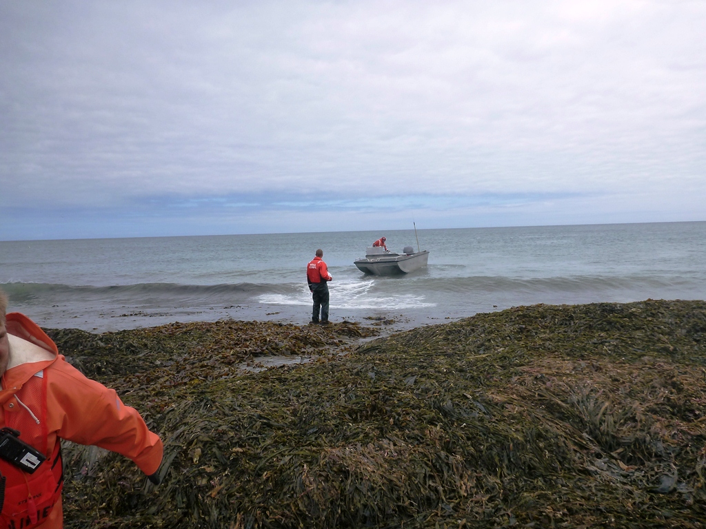
Our method for collecting sound velocity profiles is by using a CTD on the launch, or an MVP on the ship.
The CTD has a sensor that measures the conductivity, temperature, and depth of the water (thus CTD). We drop the unit to the seafloor, bring it back up, and collect out data from there.
The MVP is the Moving Vessel Profiler. It is basically the same thing as the CTD just on a larger scale. We use a crane to lower a towfish that contains the CTD sensor to the seafloor.

CTD

MVP

Sound Velocity Profile

DATA ACQUISITION
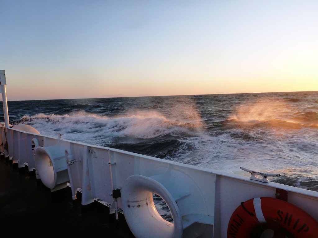
Due to the weather, we haven't been able to take the launches out for surveying too often this past week. So, we have been collecting some data with the ship's Kongsberg multibeam system. It can go much faster to acquire data with the ship because the swath is much wider due to the lower frequency.

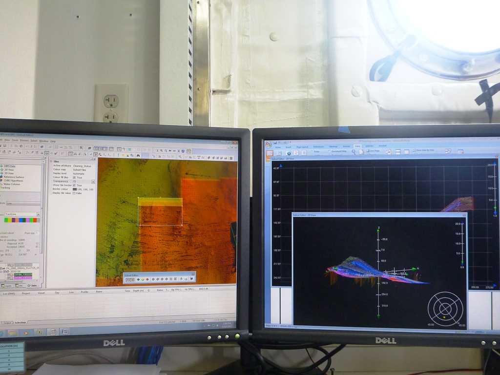
Here is the setup we have for our ship data acquisition process.
The large monitor on top shows our coverage areas and the water column. (Sometimes you can see whales and/or large schools of fish swimming through it). The far right monitor is hooked up to the MVP and allows us to remotely control the MVP (that is located on the fantail) to collect sound velocity profiles. (We have been collecting profiles approx. every 15 minutes to ensure accuracy.) The other two monitors are used for navigational purposes, our position, a log to track the data acquisition, and shows our coverage.

Hydrography

We have arrived in Seward, AK where we will be in port for the next 9 days. After that we will head back to Chirikof Island to gather more data for our survey.

Tuesday, June 26, 2012

Whales, Fishing, and Survey

So, we are still surveying different areas around Chirikof Island. We spotted more than 40 whales yesterday. There are huge pods feeding just off the coast of Chirikof. The whales don't breach very often, so it's hard to get pictures, but I got a few.

A lot of the crew has been spending time fishing. The catch has been mostly halibut and cod. Our stewards were kind enough to take the some of the catch and cook it up for us.

I have been on the night processing shift as of late. This job entails taking the data from the launches and processing it right after they come back to the ship. There are many different steps needed to process the data.

WHALES
Here are the few pictures I got of the whales. It is incredible to walk out on the fantail and see spouts everywhere you look. A few of my shipmates got to see a whale come right up to the launch when they were out surveying.


FISHING
Almost everyday that we've had nice weather, several of my shipmates have been on the fantail fishing after work.

Will catching a halibut

Right after dinner, the guys go straight to fishing

Gaffing the fish

A rockfish

A lot of halibut has been caught

Halibut and cod

Photo op of the day - John and his fish

SURVEY
We have been having some rough weather lately. The swells have been up to 10ft and the winds at about 30 knots. Today is the first calm day we've had in a while. The temperatures have been very cold, and the wind makes everything seem colder. It definitely feels like we are in Alaska.

As stated earlier, I have been on night processing this week. My shift starts at 1300 and ends at 2100 (usually). We wait for the launches to come back with their acquired data and begin processing.

Processing data involves many different steps. First the data needs to be converted into a usable format. Once this is done, we apply correctors (true heave, tides, etc.). After this, the data is cleaned. It can take a long time to clean the data but the end result is pretty cool.

Alaskan waters can be rough

One of our launches coming back to the ship after a long day of surveying

Doroba on the bow ready to throw the line

Not always an easy job

One launch acquired 31 lines then were converted, processed, and cleaned

As always, we have had the most beautiful late sunsets. I could fill albums full with the amount of sunset pictures I've taken. Here are a few more. Most of these pictures were taken around 2330.


Some nights are calm

Sunset at Chirikof Island

Some are not calm

6-7 foot swells, 25 knot winds

We will be heading to Seward, AK late tonight. We will spend about 9 days at port in Seward. During this time I will probably be working on my HIC Workbook. A HIC is the Hydrographer in Charge. It takes a long time to get qualified, but they thought it might be beneficial for me to go through the workbook, especially if I end up working on a hydro ship again.

Thursday, June 21, 2012

Chirikof Island, AK

We have arrived back at Chirikof Island which is about 60 miles southwest of Kodiak Island. The island is desolate, treeless and uninhabited (other than a herd of feral cattle). Earlier this week, I went out to the island with a crew, to install a base station. We left the ship at 14:00 and arrived back at 17:30. One concern we had regarding the installation was the herd of feral cattle. We were told that they can be somewhat aggressive. Another concern was getting onto the island. There were few places that are safe for the skiff to land. We ended up trying out a few different spots before deciding on one. Not only did we have to get people off the boat, but also a lot of heavy equipment.

View of Chirikof Island from the ship

Chirikof Island - The pin on the north side indicates where we installed the base station

Base station on Chirikof

BASE STATION INSTALLATION
The point of installing a base station is to provide Global Navigational Satellite System (GNSS) data to support three-dimensional positioning.  This will work in collaboration with our tide gauge to give us accurate information that will help us record and correct or data properly.


Provided by NOAA


Diagram of a base station setup - provided by NOAA

There aren't many good landing spots on Chirikof Island. Our coxswain had to drive head on (at a 90 degree angle) to the island in order to let us off the bow of the boat. This became a bit problematic with the waves. Luckily we all made it safely along with all the equipment needed.

The first good location we scouted was immediately tossed due to this cow...staring at us. We didn't want to risk getting in their way, especially without any weapons or any kind of defense. Not only did he stare at us, but he followed us when we decided to find a different location to land. Since the watch cow wouldn't leave, we finally decided to go much further north.

Feral cow on Chirikof Island

We got lucky with the weather. It ended up being a fairly nice day (especially considering our location). Chirikof tends to get very harsh weather.

GETTING ON LAND
Here are a few pictures to show how we had to get off the skiff. Two of my crew mates jumped off first while I handed them our gear in between wave sets. It was not a simple task and was often interrupted by crashing waves.


Yes, that is a huge pile of kelp.

Finally on land...our coxswain waited for us to set up the base station.

SETUP
Once we got on land, we got right to work on our installation. First we set up the tripods, installed the antennas, attached the batteries and solar panels, hooked up the computer, etc. It went relatively quickly. We used large rocks and logs to secure our equipment.
Side note: The cows left us alone the entire time we were on the island.

Bart and Doroba leveling the tripod

Doroba setting up the solar panels

Our base station

Level tripod

SURVEYING
Yesterday I got to go out on a launch to run some crosslines. That means we drove over a  certain area in a linear fashion while collecting multibeam data. (Instead of filling in an entire polygon). I learned the setup of the computers on the launch, how to manipulate the RESON multibeam to make sure we were collecting accurate/valid data, and how to transfer all the files off the launch to the ship.

I have also been spending some of my time learning more about processing and cleaning data. There are so many steps to go through in order to get an end product. This is why I'm very glad I have extended my internship through the fall semester. There is so much to learn.

Using Caris Hips and Sips software to correct and clean data


After a long day of work, many of my shipmates have been fishing off the fantail. One of these days I will get out a kayak and go explore the area.

Halibut caught off the fantail of the Rainier

Friday, June 15, 2012

Kodiak, Alaska

So, we are currently at port at the Coast Guard Station in Kodiak, Alaska. Earlier this week we went to Chirikof Island (just southwest of Kodiak Island) to check out some of our survey areas. After that we cruised up to Kodiak for the weekend. It has been fairly cold and grey since arriving in Kodiak.

A crew going to check out Chirikof Island on a skiff

Coming into Kodiak


Kodiak, Alaska


TRAINING
Yesterday we spent the day split up in groups learning and practicing boat maneuvering. The first half of the day, my group ran through various evolutions in a launch. The second half of the day was spent training in a skiff. The purpose of this training is to get acquainted and comfortable with the boats so, in case of an emergency, each of us will know how to take over and get back to the ship safely. It was a very active day.

The different drills we went through included: coming along side, man overboard drills, pivot turns on the skiff, line handling, and overall boat safety.
Coming along side was the first thing we learned how to do. Since I have zero boating experience, it was interesting to get to do this. Our process involved coming at the target (this can be a pier, the ship, etc.) at a 45 degree angle then sliding the boat into the desired spot. I was able to practice this maneuver enough until I was comfortable performing this task on both the launch and the skiff. In addition to coming along side, we learned beach landings. This is for a situation where we are unloading people/gear/supplies from the bow. There are many important things to be aware of in this situation. Mostly, you need to be aware of the depth, any obstacles like rocks or boulders, currents, tides, waves, etc.

The man overboard drills involve alerting the coxswain of the location of the lost person/item. Once it is called out, several (or all) persons on the boat, point in the direction the coxswain needs to go for pick up. Someone else will grab the boat hook and retrieve the lost person once along side. Each of us got a chance to be the driver.
Man overboard drills differ a bit when on the skiff. Since it is a much faster boat, we learned to do pivot turns at full speed to retrieve a lost person. Full speed in these boats can be up to 30 knots.


Man overboard drills

After alerting the coxswain of a man overboard situation, we must point at the person overboard at all times. 

Each of us got many chances to drive the boats, learning and practicing coming along side, man overboard drills, etc.

We also learned beach landings on both the skiffs and launches

Brandy driving the skiff, practicing coming along side

Me learning pivot turns on a skiff


Brandy executing a pivot turn


It's very strange being in a place that stays light for so long. I'll be out at 10:30 at night and it feels like the afternoon. Alaska is a very different lifestyle.
I have taken to playing hacky sack on the fantail with my shipmates after work, while watching the sunset.

Sunset on our way to Kodiak at 10:15pm

As far as I know, the plan is to re-fuel on Monday and head back to Chirikof Island where we will be surveying. This will be another great chance to get some more hands-on experience with acquiring and processing data.
Until then, here we are in Kodiak.