Sunday, September 16, 2012

Bottom sampling, tilted sonars, and windy days at sea

It is day number 260 and we are currently anchored in the Northeast Harbor of the Shumagin Islands. We have cancelled operations for the day due to extreme weather. Even at anchor, the ship is rolling significantly. You can barely tell that we are anchored at all. There are gusts of wind from 60-80 knots with the winds coming out of the West Southwest at 40-45 knots. The forecast for the seas is at 20ft (luckily not inside the harbor where we can safely wait out the storm).
The winds are so strong at the surface that the waves are getting picked up into the air. Mist is surrounding the Rainier. I'm happy to be on the ship and not out in this weather today.

Anchorage in Northeast Harbor


Windy day in the Shumagins

Gusts up to 80 knots inside the Northeast Harbor

BOTTOM SAMPLING
Over the past few weeks I have been on the bottom sampling boats. This requires us to go out to various locations, drop a bottom sampling tool, collect a sample (if possible), record and move to the next one. The day is spent mostly transiting. Collecting bottom samples is part of the project instructions and serves several different purposes, one of which is used for anchoring.
We use a winch to drop and retrieve our bottom samplers. This can be preferable to dropping the sampler that is attached to a line and retrieving it by hand...especially in deep waters.
Our standards for bottom sampling is as follows:
If no sample is collected after three tries, it is considered unknown. Otherwise, there are many different classifications. Most of the samples we collected included fine grey sand, broken shell, seaweed, medium to coarse sand, etc. One of our bottom samples even included a little crab scurrying about the sample pan.

The bottom samples we were able to collect in one day. The "T" symbol describes the location.


Retrieving the bottom sampler using a winch

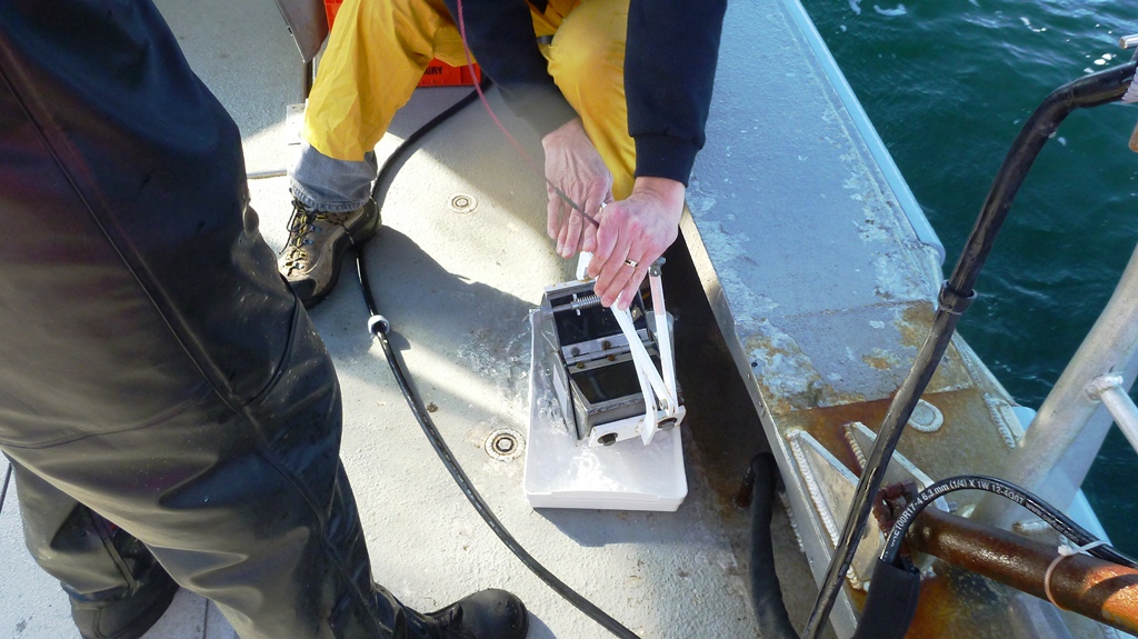
Opening the bottom sampler

A bottom sample....we even caught a crab!

These bottom samplers can be tricky. You have to have the right touch to get them to work properly.

A good bottom sample of mostly broken shell

A great bottom sample of mostly broken shell

TILTED SONAR
Yesterday, I went out on the launch that has the 8125 tilted sonar mounted on it. We use this sonar to do shoreline work because it allows us to see further inshore without having to get too close. This is very helpful when there are unknown rocks or lots of kelp in the way. It keeps the launch safe without having to forgo collecting data.
The sonar operates a bit differently than the standard 7125 multibeam sonars (that I'm used to). We have a different computer and monitor (which tilts so we can see the sea floor better).

Tilted sonar (with a tilted monitor)

Shoreline investigation using the 8125 sonar

Shoreline

I got to see a gorgeous sunrise the second time I went out bottom sampling. We were lucky to have better weather. This is getting to be a rare thing in Northeast Alaska in the middle of September.

Sunrise in the Shumagin Islands

Sunrise before going out to do bottom sampling

Two of our launches leaving the ship for hydro operations

Beautiful morning at sea

Shumagin Islands

Here are some more wave pictures I was able to capture. Unfortunately the pictures just can't do it justice. The waves can be spectacular.


Waves crashing over the bow

COVERAGE
Here is the most recent coverage of my sheet and the entire project area. We are getting close to being done. This is a combination of the launches going out to collect multibeam data as well as the ship acquiring data.

Coverage on my sheet up to day 259

Coverage of our project area up to day 259

I wish I could be posting more often, unfortunately our internet connection isn't the best out here in the Shumagins. Some days we are barely connected at all.
We plan to start our transit back to Kodiak on Tuesday for a weekend inport. The transit takes about 35 hours, so we plan to get into Kodiak on Thursday.
Greetings from Alaska!

Getting into our "gumby" suits (survival suits) during an abandon ship drill

Wednesday, September 5, 2012

Return to the Shumagins

INPORT: KODIAK

We are currently in Kodiak, which is also where our remaining inports will be. We are scheduled to leave Kodiak tomorrow at 1300 and head back to our new survey area: The Shumagin Islands. It is an approximated 33-hour transit from Kodiak to the Shumagins. Once we arrive, it's back to work.

The following is the most recent coverage we have acquired with multibeam sonar.

Coverage of the Shumagin Island survey area

Here is a closer look at what we've acquired on my assigned sheet.

Multibeam coverage

During our next leg we will spend 16 days at sea. The weather has been moving in. Today's report was 23 ft. seas in the Shumagins. We're hoping it will fall by the time we get there, allowing us to get some good data. On our last leg in the Shumagins, we were allowed to go ashore for a beach party. It's always nice getting to go explore the islands and look for treasures and shells on the beach. We usually set up a nice campfire and enjoy being on solid ground.

BEACH PARTY AT THE SHUMAGINS

Getting off the ship...

Heading to the beach!

Our beach party

The campfire

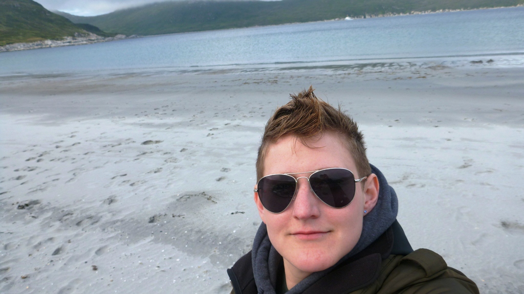
Me on the island

Jellies

Huge line washed up between the rocks on the beach

Panoramic view of the beach

Such a beautiful spot

Bird tracks

Beach party!
...More to come as we continue to gather and process data. I'm also working on a ship-life blog, just to give everyone an idea of what it's like here on the Rainier. 
Till next time, greetings from Kodiak!

Tuesday, August 28, 2012

Shumagin Islands

We have been working at our survey area in the Shumagin Islands for the past week. On Saturday we spent the entire day on a nearby island installing a tide gauge and base station. It was a beautiful day and a nice treat to get to go on land.
Today, we have two boats out surveying on my assigned sheet. I had to do some prep work for it last night and write up boat sheets so they would know where to go.

BASE STATION INSTALL
The base station install was a great success. We had a small Horcon team working on that and a large tide gauge team (including divers) installing a tide gauge at the same time. All of this was installed in the same area. This allowed us to work together and get everything done much quicker and with more ease. We were able to get a boat right up to the island to transfer personnel and gear. (It was much easier than at Chirikof Island).

Once we arrived, we got to work by bringing all the Horcon (Horizontal Control) gear to the top of the island. Once ready to set up, we (the Horcon team) had to install a benchmark. We install benchmarks for the level to be placed on top of, along side the antenna. This involves drilling into bedrock, applying concrete, and inserting the benchmark so it is level and doesn't move around.

Tide gauge party

Tide staff

Horcon site

Drilling into bedrock to install benchmark


Chiseling the area so the benchmark will fit properly

Mixing the cement for the benchmark


We also made sure that the benchmark itself was level before letting the concrete dry

Once the base station was setup we installed some bolts into the bedrock so the solar panels could be secured. Although it was a gorgeous day, we need to think about the kind of weather that occurs in the Shumagins. We certainly don't want to lose any of our gear because it wasn't secured properly.
We used parachute chord to tie the solar panels down to the bolts. Once this was accomplished we plugged the solar panels into the batteries that power the base station to make sure everything was working properly.


Securing solar panels for the base station

Leveling

Everything has to be very secure due to extreme weather

Base station

Making sure it is still level
Completed base station

As we were finishing up, the tide party was completing their level run

After a day on the island, the fog rolled in. It was spectacular to see the fog fall like that

BOAT SHEETS
Just a little refresher on what polygons are and why/how we use them. Each survey area we are assigned to is broken up into different sheets. These sheets are assigned to a sheet manager (who may also have a sheet mentor or assistant ). Each sheet manager is then responsible for determining the way the data is acquired by drawing polygons (with approval, of course). The Shumagin Islands survey has been broken up into 9 sheets, as shown below.

Shumagin Islands Survey area

 Each sheet manager spends time drawing polygons within their sheet limits. The polygons become "workable" areas for the launches. So, when we send the launches out, we can assign a certain number of polygons to them in a certain area that we predetermine as safe. It also allows us to be flexible in cases of bad weather. A launch can move to a different polygon in a more protected area, for example.

Today, we sent out four launches to do data acquisition, two of which are acquiring data on my sheet. In order for the launches to do this, the sheet managers have to make a boat sheet. Our boat sheets instruct the launch party where they need to survey, which polygons to fill in, what files have been uploaded, any dangers, etc. It is important to include any and all information relevant to the area that they are surveying. Here is my boat sheet.

 
I have been assigned to night processing tonight, so I'm looking forward to getting my hands on some data for my sheet.

DATA ACQUISITION
Some days are better than others for data acquisition. We have been lucky with the weather thus far, but we have had some more crummy days as of late.
Here are some cool pictures I took while on a launch. We were planning on going out to survey, but the weather picked up quickly, so we returned to the ship.


Launch hiding behind a large wave


We have had some bumpy transits as well. I was lucky to get some great wave and sunset pictures.


Our next inport will be Kodiak, again. We will arrive in Kodiak on Friday and spend the long weekend there before heading back out to the Shumagin Islands.